


Pear Technology
Since 1995 Pear Technology have been providing digital mapping to farms, estates, land agents, conservationists, solicitors and many more. As partners with Ordnance Survey, we have prepared over 1,000,000 ha of maps for UK land managers.
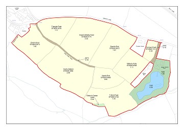
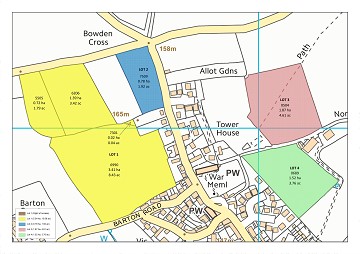
With recent developments in all forms of map data, land management is becoming more efficient with the powerful tools available. Using the most accurate and up to date data available from the Ordnance Survey means you can have confidence in the data whilst amending your map.
More and more mapping datasets are becoming available with organisations such as the RPA, Land Registry, Natural England, Forestry Commission and English Heritage all providing data which can be imported directly into PT-Mapper (digital map editing system). Overlay this with OS data for your area and immediately you are presented with new insights and opportunities as a forward looking land manager.
Keeping the data dynamic with real time data capture, importing and exporting data from GPS devices and sharing information with third parties keeps everyone aware and moving forward.
No longer are these essential technologies for land management daunting. They are simple to use and significantly aid the management process.
Pear Technology support and assist all our customers with high quality technical support, services and training. Contact us today to find out more.
Freddie Ryan - fryan@peartechnology.co.uk
02392499689
Stand Number: FR740